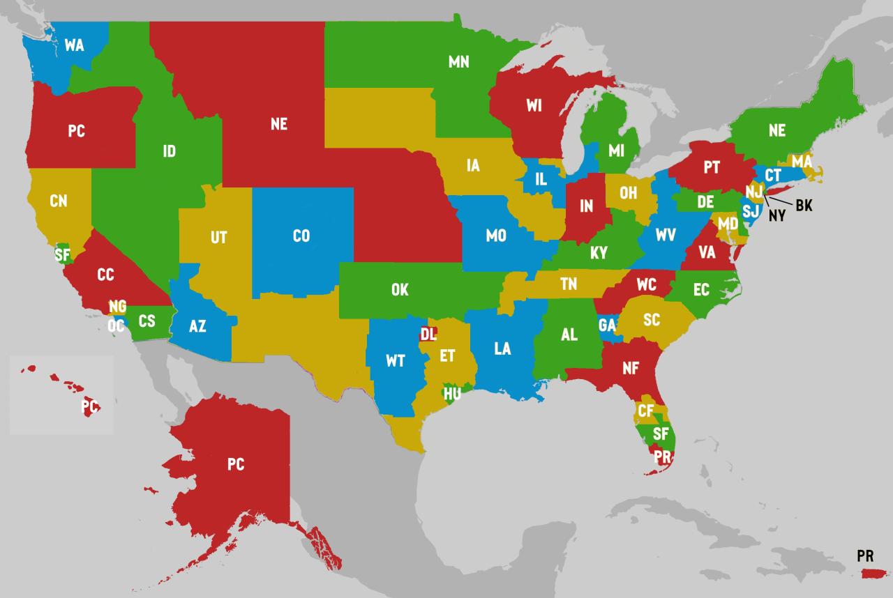
Here's an interesting redraw of the USA where every state has (more or less) the same population.
by u/mikevago
Methodology: I tried to respect existing state borders wherever possible (which is why you get a few western states chained together that are pretty spread out geographically). I got my data from the US Census’ very cool county-by-county 2020 population map, and the only counties I had to break up were Los Angeles and San Bernardino.
The average population of the states is 6.6 million, and most of these are within half a million of that. Brooklyn is the biggest outlier at 6153515; West Texas is the largest at 6894256.
And some state abbreviations you may be unfamiliar with (West to East):
PC is Pacifica (Oregon, Alaska, Hawaii, Guam)
CN/CC/CS are North, Central, and South California (flipped the abbreviation to avoid confusion with the Carolinas)
NG is Los aNGeles (since LA was already taken)OC is Orange County
WT/ET is East/West Texas
DL is Dallas
HU is Houston
NF/CF/SF is North/Central/South Florida (the southernmost part of Florida is part of Puerto Rico)
PT is Pennsyltucky
NY is Manhattan, Queens, the Bronx, and Jersey City
BK is Brooklyn, Staten and Long Islands
MD is still Maryland, and includes Washington DC.
No comments:
Post a Comment